Planning documents filed with the responsible body
Application material for the Gewerbepark MN project exists in the planning record and has been filed for review. We link to the record entry so visitors can read the filing directly.
This page describes the proposed commercial park near Maring-Noviand: where the site is, what stage the planning has reached, what has been confirmed in writing, and what remains an open question. It also states the association's position, kept visibly separate from the factual record.
The proposed area lies within the municipality of Maring-Noviand in the Bernkastel-Wittlich district, Rhineland-Palatinate. The surrounding land is agricultural and viticultural, with the Moselle valley nearby and a road network that already carries local and visitor traffic.
Any commercial development here sits between a working landscape and a small residential village, which is why access roads and noise carry more weight in this case than in a purely industrial location. The road through Maring-Noviand is the same road residents use daily; agricultural vehicles, wine tourism coaches, and commuter traffic already share it.
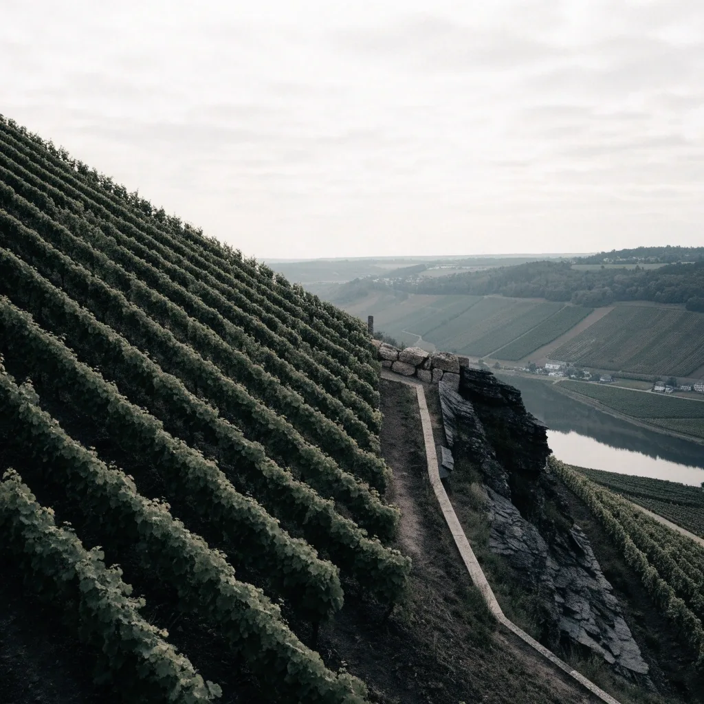
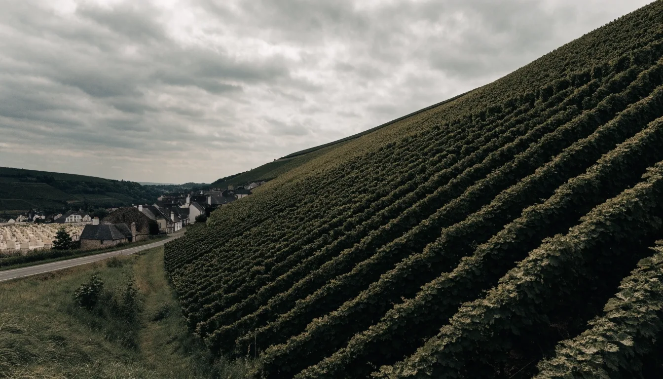
Steep valley slopes with fast downhill water movement, not the flat ground a standard commercial estate assumes.
Working vineyards and agricultural parcels sit directly against the proposed boundary.
Village roads already carry harvest vehicles, wine tourism, and daily commuter movement.
A Gewerbepark is a designated zone for commercial and light industrial use. Designation normally runs through land-use planning — Bauleitplanung in German — which involves the municipality, the district administration, and public participation steps.
Until the planning steps are completed and documented, the term describes an intention on paper. It does not describe a built site, and we do not use it as if it did.
Bauleitplanung moves through municipal consultation, formal participation steps, and district-level review, with defined periods for public comment. The exact sequence depends on the procedure chosen.
We track each announced stage on our timeline. When a stage has not been announced, we do not write it into the record — the gap itself is part of what we publish.
Confirmed items are those we can trace to a written statement from a responsible body. Each one links to the document that supports it.
Application material for the Gewerbepark MN project exists in the planning record and has been filed for review. We link to the record entry so visitors can read the filing directly.
Council agendas and decisions where the project was discussed appear in the municipal record. These are the documents that put the project into official discussion, and we cite each one.
Where the association has asked a question in writing and received a written answer, the reply is published and dated. These replies are what make the confirmed record verifiable rather than secondhand.
That the Gewerbepark MN proposal is a live item in the municipality's discussions is confirmed by the record itself. We treat this as the floor of what is confirmed, not as agreement that it should proceed.
If a link goes dead, we say so on the entry rather than removing it quietly. A missing source is a fact about the record, and we publish it as one.
Plans are documents that propose something without a decision attached. Draft site layouts, traffic sketches, and preliminary zoning ideas fall here. They matter, because a draft often shapes the decisions that follow — but they are not decisions, and we never present them as such.
We label drafts as plans and note the date of the version we are quoting. Drafts change between revisions, and two residents can end up arguing about different papers without ever realising it. The date on our entry is the version we read.
Several questions remain unresolved in the material we have. We list them as open questions instead of guessing at answers, and we ask them in writing so the responses can be published when they arrive.
How would rainfall that currently soaks into vineyard ground be handled once a commercial surface seals it? Final drainage figures have not appeared in the material we have.
What does additional commercial traffic do to the village road through Maring-Noviand at peak times, layered onto the harvest and tourism movement already on it?
Was an alternative location assessed, and on what criteria? The documents we have collected do not say whether the comparison was made or what it considered.
Which participation procedure will be applied, and when will the formal comment period open? No announcement has been published that we can point to.
Our position was adopted at a general meeting and recorded in the minutes. Any development decision should rest on a documented traffic assessment, a published drainage concept, and an assessment of at least one alternative location.
That is a position, not a fact, and it is labelled as ours. Members have disagreed on details, and the meeting minutes show where. We publish the disagreement alongside the decision — a position adopted without the argument that produced it would be a slogan.
Three conditions the association asks any development decision to meet before it proceeds.
Minutes available via our documents page
Access to the site would run through or near the existing village road network. Local traffic already includes agricultural vehicles, wine tourism, and commuter movement to the district's larger towns. A commercial park adds delivery and staff journeys to that mix.
Our documentation tracks published traffic figures and any counter-arguments. We mark which numbers come from official studies and which come from estimates inside draft material — the two carry different weight, and mixing them silently would be misleading.
Each entry on The Timeline carries this label and a link to the document behind it.
The Moselle valley's land is steep, and water runs downhill fast. A sealed commercial surface changes where rain goes, and drainage that works on flat ground can behave differently here.
The documents we have collected so far contain preliminary drainage language without final figures. We record what has been published, flag what is missing, and link to the relevant filings. Until a drainage concept is published with figures, the effect on the surrounding parcels remains an open question in our record.
Steep parcels above Maring-Noviand: the terrain changes how rainfall behaves once any surface is sealed.
Planning for a project of this kind typically moves through municipal consultation, formal participation steps, and district-level review, with defined periods for public comment. The exact sequence depends on the procedure chosen.
The municipality discusses the proposal and records its own decisions. Agendas and outcomes from this stage are the earliest entries on our timeline.
Public participation steps follow the procedure chosen, with a defined window for comment. The window only becomes a date on our record once it is announced.
The district administration reviews the plan against its own requirements. A decision at this level is what would turn the term from intention into designation.
Each stage is written into the timeline on the date it is officially announced. When a stage has not been announced, we do not write it into the record.
Every claim on this page sits on a document. If you want to check the filing behind a confirmed fact, browse the source documents. If you want to see when each item entered the record, read the timeline. If you have a question about the project, the association answers in writing so the reply can be published.
Bürgerinitiative PRO Gewerbepark MN e.V. — Im Webersgarten 25, 54484 Maring-Noviand, Germany. The association's record covers the proposed business park in Maring-Noviand and the questions the area's residents have raised about it.
The association is registered in Maring-Noviand and writes about a proposed business park in the same municipality. If you prefer to send a question in writing, the address below reaches us.
Office hours Monday to Friday, 9:00 AM – 6:00 PM